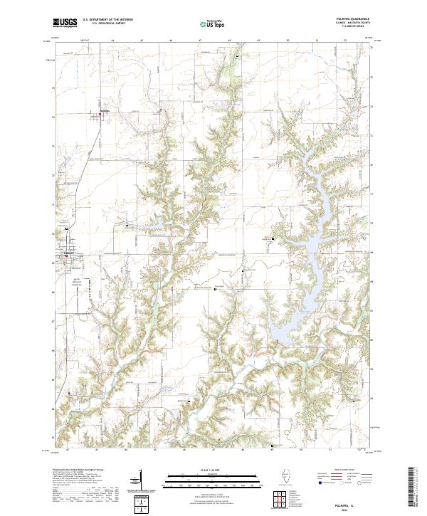
2024 Map of Palmyra
USGS Topo · Published 2024About this map
Otter Lake dominates the eastern half of this Macoupin County landscape, its winding shoreline carving deep into the agricultural terrain south of Modesto. The area is defined by a dense network of country roads, including Emmerson Airline Rd and Blooming Grove Rd, which connect scattered family burial sites and rural settlements. Genealogists will find a concentration of local history at Blue Grass Cem, ONeal Cem, and the secluded Doss Grave. The terrain transitions from the open fields surrounding Lake Greenwood in the north to the more complex drainages of West Fork Otter Creek and East Fork Otter Creek. Aviation history is present at the Zelmer Memorial Airpark Inc, while several creek branches, such as Wolf Branch and Nassa Creek, show the natural drainage patterns that have shaped the township lines and property boundaries of this central Illinois region.
Find a feature on this map
58 named features on this map. Tap any name to fly to it.
Don’t see what you’re looking for? This feature index may not catch every label — zoom into the map to look around manually.
Map Details
Editions of this 2024 Palmyra Map
This is the sole edition of this map. No revisions or reprints were ever made.
Other maps of this area

1923 · Carlinville
USGS Topo · 1:48,000

1924 · Waverly
USGS Topo · 1:62,500

1925 · Carlinville
USGS Topo · 1:62,500

1926 · Waverly
USGS Topo · 1:62,500

1931 · Carlinville
USGS Topo · 1:62,500

1932 · Greenfield
USGS Topo · 1:62,500

1932 · Jacksonville
USGS Topo · 1:62,500

1937 · Jacksonville
USGS Topo · 1:62,500

1948 · Quincy
USGS Topo · 1:250,000

1956 · Quincy
USGS Topo · 1:250,000