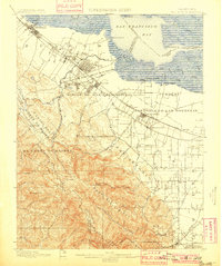
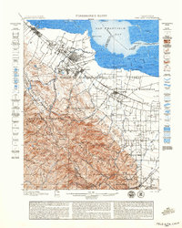
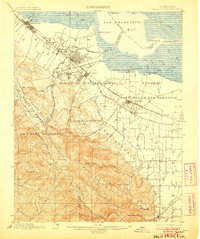
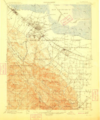
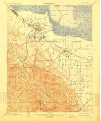
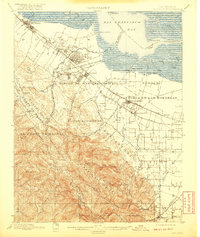
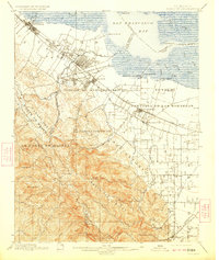
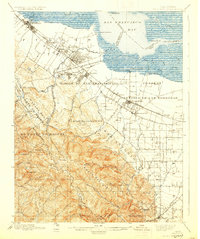
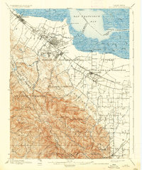
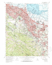
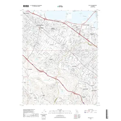
1899 Map of Palo Alto
USGS Topo · Published 1901About this map
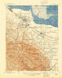
The Southern Pacific RR and the Monterey Line anchor the developing landscape of the South Bay in this 1895 survey. The map details the transition from the large Spanish land grants, like Rincon De San Francisquito and Pastoria De Las Borregas, into the grid-patterned towns of Palo Alto, Mayfield, and Mountain View. The newly founded Stanford University stands as a prominent landmark on the edge of the foothills, while older hubs like Redwood and Menlo Park line the railroad corridor. Along the edges of San Francisco Bay, a complex network of sloughs and landings, including Cooley Landing and Guth Landing, suggests the ongoing importance of maritime transport for the region's early agricultural economy. To the southwest, the terrain rises sharply toward Monte Bello Ridge, where family-named landmarks like Langley Hill and Mindego Hill define the rugged interior before it descends toward Saratoga.
Find a feature on this map
71 named features on this map. Tap any name to fly to it.
Don’t see what you’re looking for? This feature index may not catch every label — zoom into the map to look around manually.
Map Details
Editions of this 1899 Palo Alto Map
11 editions found

1899 edition
16.6 x 19.8 inches
1899 edition
18.8 x 23.5 inches
1901 edition
16.6 x 19.8 inches
1906 edition
16.6 x 19.9 inches
1909 edition
16.6 x 19.9 inches
1911 edition
16.6 x 19.8 inches
1920 edition
16.6 x 19.7 inches
1923 edition
16.6 x 19.7 inches
1930 edition
16.6 x 19.8 inches
1937 edition
16.6 x 19.8 inches
1944 edition
16.6 x 20.8 inches
Historical Maps of San Jose Through Time
15 maps found

1897 Palo Alto
Santa Clara County, CA
1899 Palo Alto
Santa Clara County, CA

1941 Palo Alto
Santa Clara County, CA

1943 Palo Alto
Santa Clara County, CA

1948 Palo Alto
Santa Clara County, CA
1953 Palo Alto
Santa Clara County, CA
1961 Palo Alto
Santa Clara County, CA
1961 Palo Alto
Santa Clara County, CA

1982 Palo Alto
Santa Clara County, CA

1991 Palo Alto
Santa Clara County, CA
1997 Palo Alto
Santa Clara County, CA
2012 Palo Alto
Santa Clara County, CA
2015 Palo Alto
Santa Clara County, CA
2018 Palo Alto
Santa Clara County, CA
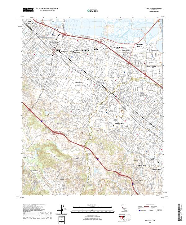
2021 Palo Alto
Santa Clara County, CA