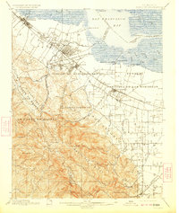
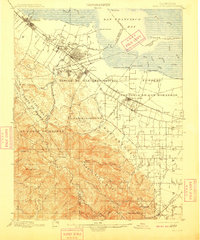
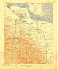
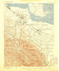
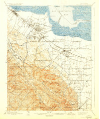
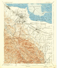
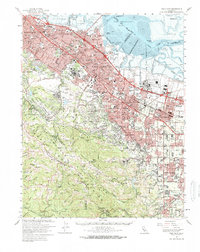
1899 Map of Palo Alto
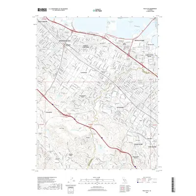
USGS Topo · Published 1923About this map
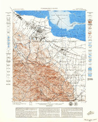
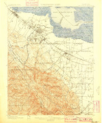
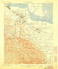
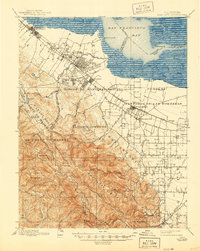
Stanford University and the nascent town of Palo Alto serve as the focal points for this late 19th-century survey of the Peninsula and Santa Clara Valley. The landscape is defined by the transition from the marshy tidelands of the San Francisco Bay, where several landings like Cooley Landing and Jagel Landing provided maritime access, to the ascending heights of the Monte Bello Ridge. The Southern Pacific RR cuts a straight path through established and growing communities such as Menlo Park, Mayfield, and Mountain View, while the massive Spanish land grant boundaries like El Corte de Madera and Pastoria de las Borregas still dictate the regional geography. The map reveals an intricate network of waterways flowing from the mountains, including San Francisquito Creek and Stevens Creek, which supported the early agricultural and institutional development of the valley floor before the intensive suburbanization of the 20th century.
Find a feature on this map
70 named features on this map. Tap any name to fly to it.
Don’t see what you’re looking for? This feature index may not catch every label — zoom into the map to look around manually.
Map Details
Editions of this 1899 Palo Alto Map
11 editions found

1899 edition
16.6 x 19.8 inches
1899 edition
18.8 x 23.5 inches
1901 edition
16.6 x 19.8 inches
1906 edition
16.6 x 19.9 inches
1909 edition
16.6 x 19.9 inches
1911 edition
16.6 x 19.8 inches
1920 edition
16.6 x 19.7 inches
1923 edition
16.6 x 19.7 inches
1930 edition
16.6 x 19.8 inches
1937 edition
16.6 x 19.8 inches
1944 edition
16.6 x 20.8 inches
Historical Maps of San Jose Through Time
15 maps found

1897 Palo Alto
Santa Clara County, CA
1899 Palo Alto
Santa Clara County, CA

1941 Palo Alto
Santa Clara County, CA

1943 Palo Alto
Santa Clara County, CA

1948 Palo Alto
Santa Clara County, CA
1953 Palo Alto
Santa Clara County, CA
1961 Palo Alto
Santa Clara County, CA
1961 Palo Alto
Santa Clara County, CA

1982 Palo Alto
Santa Clara County, CA

1991 Palo Alto
Santa Clara County, CA
1997 Palo Alto
Santa Clara County, CA
2012 Palo Alto
Santa Clara County, CA
2015 Palo Alto
Santa Clara County, CA
2018 Palo Alto
Santa Clara County, CA
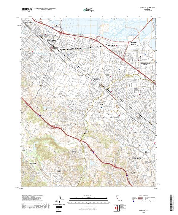
2021 Palo Alto
Santa Clara County, CA