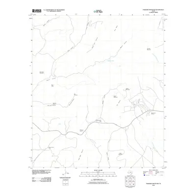
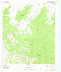
2010 Map of Paradise Mountain
USGS Topo · Published 2010About this map
The Bloys Camp Meeting site and the Barrel Springs Ranch anchor this high-altitude ranching landscape in Jeff Davis County. Established patterns of water access define the region, with the historic Barrel Spring and specialized ranch infrastructure like the Bat Cave Windmill and Box Windmill supporting operations in an area dominated by prominent peaks. Notable elevations including Paradise Mountain, Blue Seep Mountain, and Pine Mesa overlook a network of drainage systems such as Goat Canyon and the headwaters of the North Fork Alamito Creek. The map documents the persistent ranching footprints of the Trans-Pecos, tracing the relationship between family-named landmarks like Crows Nest Hill and the winding course of Skyline Dr.
Find a feature on this map
30 named features on this map. Tap any name to fly to it.
Don’t see what you’re looking for? This feature index may not catch every label — zoom into the map to look around manually.
Map Details
Editions of this 2010 Paradise Mountain Map
This is the sole edition of this map. No revisions or reprints were ever made.
Other maps of this area

1894 · Valentine
USGS Topo · 1:125,000

1895 · Marfa
USGS Topo · 1:125,000

1897 · Valentine
USGS Topo · 1:125,000

1943 · Valentine
USGS Topo · 1:125,000

1959 · Marfa
USGS Topo · 1:250,000

1965 · Marfa
USGS Topo · 1:250,000
1978 · Blue Mountain
USGS Topo · 1:24,000
1978 · Paradise Mountain
USGS Topo · 1:24,000
1978 · El Muerto Peak
USGS Topo · 1:24,000
1978 · Mount Livermore
USGS Topo · 1:24,000