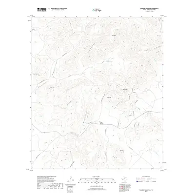
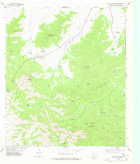
2019 Map of Paradise Mountain
USGS Topo · Published 2019About this map
Paradise Mtn rises above a high-desert landscape in Jeff Davis County, defined by its complex network of named drainages and ranching corridors. The area around Barrel Springs and Medley Draw indicates a region where water sources were critical for land management, evidenced by features like Blackeye Tank. This modern survey illustrates the persistent imprint of ranching families on the geography, with several roads and canyons named for the local Medley, Gearhart, and Kelly operations. To the south, Mine Mtn and Crows Nest Hill overlook the basin, while the north is dominated by high terrain such as Pine Mesa and White Mtn. The map tracks the winding course of Medley Canyon and Pet Canyon as they carve through the arid peaks toward the Alamito Creek forks.
Find a feature on this map
44 named features on this map. Tap any name to fly to it.
Don’t see what you’re looking for? This feature index may not catch every label — zoom into the map to look around manually.
Map Details
Editions of this 2019 Paradise Mountain Map
This is the sole edition of this map. No revisions or reprints were ever made.
Other maps of this area

1894 · Valentine
USGS Topo · 1:125,000

1895 · Marfa
USGS Topo · 1:125,000

1897 · Valentine
USGS Topo · 1:125,000

1943 · Valentine
USGS Topo · 1:125,000

1959 · Marfa
USGS Topo · 1:250,000

1965 · Marfa
USGS Topo · 1:250,000
1978 · Blue Mountain
USGS Topo · 1:24,000
1978 · Paradise Mountain
USGS Topo · 1:24,000
1978 · El Muerto Peak
USGS Topo · 1:24,000
1978 · Mount Livermore
USGS Topo · 1:24,000