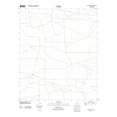
2010 Map of Parish Ranch
USGS Topo · Published 2010About this map
Rio Peñasco flows across the northern reaches of this arid landscape, defining a ranching corridor in the high plains of Eddy County. The map documents the persistent layout of western land management in the early 21st century, where large-scale operations like Parish Ranch and Coffin Ranch anchor a network of unpaved access roads and water resources. The terrain is deeply grooved by seasonal drainage patterns, most notably the wide paths of Fourmile Draw, Gardner Draw, and Segrest Draw. These intermittent watercourses eventually feed into North Seven Rivers, illustrating the complex hydrology of the Chihuahuan Desert. Local infrastructure is sparse, characterized by vital water collection points such as Hoag Tank and a grid of rural routes including Rio Penasco Rd and County Rd-50, which facilitate movement between these isolated cattle stations and remote homesteads.
Find a feature on this map
18 named features on this map. Tap any name to fly to it.
Don’t see what you’re looking for? This feature index may not catch every label — zoom into the map to look around manually.
Map Details
Editions of this 2010 Parish Ranch Map
This is the sole edition of this map. No revisions or reprints were ever made.
Other maps of this area

1954 · Seven Rivers
USGS Topo · 1:24,000

1954 · Carlsbad
USGS Topo · 1:250,000

1955 · Artesia
USGS Topo · 1:24,000

1955 · Dayton
USGS Topo · 1:24,000

1955 · Hope
USGS Topo · 1:24,000

1956 · Hope
USGS Topo · 1:24,000

1956 · Parish Ranch
USGS Topo · 1:24,000

1956 · Antelope Sink
USGS Topo · 1:24,000

1956 · Hope SE
USGS Topo · 1:24,000

1957 · Foster Ranch
USGS Topo · 1:24,000