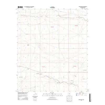
2013 Map of Parish Ranch
USGS Topo · Published 2013About this map
Rio Peñasco meanders across the arid northern reaches of this landscape, carving a distinct corridor through the high plains of Eddy County. The map documents a sparsely settled ranching region defined by its drainage systems and water management, where named features like Hoag Tank indicate the vital importance of livestock watering holes in this dry environment. Central to the local geography are several large landholdings, including Coffin Ranch along the western edge and Parish Ranch toward the east. The terrain is deeply inscribed by numerous dry washes and ephemeral watercourses, such as Red Tank Draw, Cat Claw Draw, and Fourmile Draw, which eventually feed into the North Seven Rivers system. A network of rural routes, including Co Road 21 and Co Road 50, connects these remote outposts, following the natural contours of the draws and the township and range boundaries established by the BLM.
Find a feature on this map
23 named features on this map. Tap any name to fly to it.
Don’t see what you’re looking for? This feature index may not catch every label — zoom into the map to look around manually.
Map Details
Editions of this 2013 Parish Ranch Map
This is the sole edition of this map. No revisions or reprints were ever made.
Other maps of this area

1954 · Seven Rivers
USGS Topo · 1:24,000

1954 · Carlsbad
USGS Topo · 1:250,000

1955 · Artesia
USGS Topo · 1:24,000

1955 · Dayton
USGS Topo · 1:24,000

1955 · Hope
USGS Topo · 1:24,000

1956 · Hope
USGS Topo · 1:24,000

1956 · Parish Ranch
USGS Topo · 1:24,000

1956 · Antelope Sink
USGS Topo · 1:24,000

1956 · Hope SE
USGS Topo · 1:24,000

1957 · Foster Ranch
USGS Topo · 1:24,000