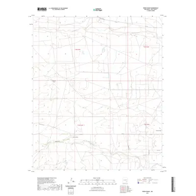
2023 Map of Parish Ranch
USGS Topo · Published 2023About this map
Rio Peñasco meanders through the northern reaches of this Eddy County landscape, defining the hydrology of an area marked by traditional ranching infrastructure and seasonal drainage patterns. The map illustrates a complex network of draws that channel water across the terrain, including Red Tank Draw in the northwest and Gardner Draw further south. These features, along with Segrest Draw and Fourmile Draw, are critical to understanding the natural movement of water in this arid environment. Human activity is evidenced by a grid of county roads and distinctive ranching landmarks such as Hoag Tank. Local transit relies on thoroughfares like Rocking R Red Rd and Crossbuck Rd, which connect remote sections of the Parish Ranch quadrangle. The survey reveals how land divisions and water management have shaped the development of this New Mexico territory.
Find a feature on this map
19 named features on this map. Tap any name to fly to it.
Don’t see what you’re looking for? This feature index may not catch every label — zoom into the map to look around manually.
Map Details
Editions of this 2023 Parish Ranch Map
This is the sole edition of this map. No revisions or reprints were ever made.
Other maps of this area

1954 · Seven Rivers
USGS Topo · 1:24,000

1954 · Carlsbad
USGS Topo · 1:250,000

1955 · Artesia
USGS Topo · 1:24,000

1955 · Dayton
USGS Topo · 1:24,000

1955 · Hope
USGS Topo · 1:24,000

1956 · Hope
USGS Topo · 1:24,000

1956 · Parish Ranch
USGS Topo · 1:24,000

1956 · Antelope Sink
USGS Topo · 1:24,000

1956 · Hope SE
USGS Topo · 1:24,000

1957 · Foster Ranch
USGS Topo · 1:24,000