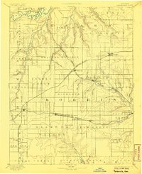
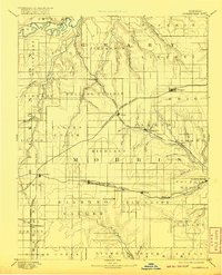
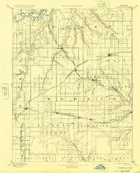
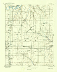
1894 Map of Parkerville
USGS Topo · Published 1906About this map
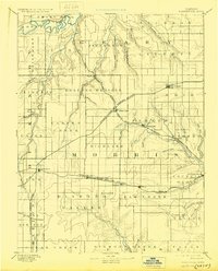
Rolling Prairie dominates the landscape of Morris and Geary counties, where a dense network of early rail lines converged to serve the agricultural heartland. Surveyed by E.T. Perkins Jr. in the 1880s, the map reveals the critical importance of water and steam-era transport. The Neosho River and Smoky Hill River carve through the plains, flanked by numerous smaller tributaries like Lyon Creek and Clarks Creek.
Find a feature on this map
65 named features on this map. Tap any name to fly to it.
Don’t see what you’re looking for? This feature index may not catch every label — zoom into the map to look around manually.
Map Details
Editions of this 1894 Parkerville Map
6 editions found

Other maps of this area

1885 · Eskridge
USGS Topo · 1:125,000

1886 · Junction City
USGS Topo · 1:125,000

1888 · Emporia
USGS Topo · 1:125,000

1889 · Newton
USGS Topo · 1:125,000

1889 · Wamego
USGS Topo · 1:125,000

1889 · Junction City
USGS Topo · 1:125,000

1889 · Abilene
USGS Topo · 1:125,000

1889 · Parkerville
USGS Topo · 1:125,000

1889 · Eskridge
USGS Topo · 1:125,000

1891 · Clay Center
USGS Topo · 1:125,000