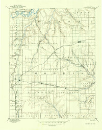
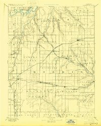
1894 Map of Parkerville
USGS Topo · Published 1930About this map
The Smoky Hill River and the Neosho River define the divergent drainage patterns across this section of the Kansas prairie, captured here following an 1885 survey. In the north, the Union Pacific Railroad traces the bend of the Smoky Hill near Skiddy, while the southern half is dominated by the Topeka Salina and Western Railroad serving settlements like Delavan, Wilsey, and Milton. The landscape transitions from the Rolling Prairie in the north to the distinctive Diamond Valley in the south.
Find a feature on this map
73 named features on this map. Tap any name to fly to it.
Don’t see what you’re looking for? This feature index may not catch every label — zoom into the map to look around manually.
Map Details
Editions of this 1894 Parkerville Map
6 editions found

Other maps of this area

1885 · Eskridge
USGS Topo · 1:125,000

1886 · Junction City
USGS Topo · 1:125,000

1888 · Emporia
USGS Topo · 1:125,000

1889 · Newton
USGS Topo · 1:125,000

1889 · Wamego
USGS Topo · 1:125,000

1889 · Junction City
USGS Topo · 1:125,000

1889 · Abilene
USGS Topo · 1:125,000

1889 · Parkerville
USGS Topo · 1:125,000

1889 · Eskridge
USGS Topo · 1:125,000

1891 · Clay Center
USGS Topo · 1:125,000