
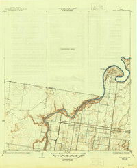
1933 Map of Paso Real
USGS Topo · Published 1933About this map
Arroyo Colorado meanders through this landscape, serving as a vital natural artery and boundary between Willacy Co and Cameron Co. The settlement of Paso Real sits at a strategic crossing point where a Ferry historically connected the north and south banks, long before permanent bridges dominated the region. The map reflects a period of developing transportation infrastructure, where established routes like Paredes Line Road 3 Mi. and East Road served the agricultural interior.
Find a feature on this map
16 named features on this map. Tap any name to fly to it.
Don’t see what you’re looking for? This feature index may not catch every label — zoom into the map to look around manually.
Map Details
Editions of this 1933 Paso Real Map
2 editions found
Other maps of this area

1929 · Rio Hondo
USGS Topo · 1:24,000

1929 · Harlingen
USGS Topo · 1:24,000

1930 · La Leona
USGS Topo · 1:24,000

1930 · Laguna Atascosa
USGS Topo · 1:24,000

1932 · Combes
USGS Topo · 1:31,680

1932 · Rio Hondo
USGS Topo · 1:31,680

1932 · Harlingen
USGS Topo · 1:31,680

1936 · La Leona
USGS Topo · 1:31,680
1936 · Laguna Atascosa
USGS Topo · 1:31,680

1952 · Hawk Island
USGS Topo · 1:24,000