
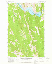
1958 Map of Patricks Basin
USGS Topo · Published 1960About this map
Gibson Reservoir serves as a central landmark in this 1958 survey, where the Sun River is impounded at a spillway elevation of 4725 feet. This high-country landscape within the Lewis and Clark National Forest is defined by a network of drainage systems, including Beaver Creek and Allan Creek, which flow through a series of steep basins. The map documents sparse human infrastructure in the backcountry, notably the Klick Lower Ranch and a set of Sheep Sheds, illustrating the area's use for seasonal grazing and water management. High peaks such as Renshaw Mountain and Allan Mountain tower over Patricks Basin, while a primary Pack Trail provides the only significant overland access through the limestone formations of the Black Reef. Small alpine water bodies like Renshaw Lake and Hidden Lake are scattered across the southern high ground, away from the more developed reservoir infrastructure.
Find a feature on this map
46 named features on this map. Tap any name to fly to it.
Don’t see what you’re looking for? This feature index may not catch every label — zoom into the map to look around manually.
Map Details
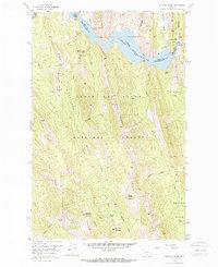
Editions of this 1958 Patricks Basin Map
3 editions found
Other maps of this area

1903 · Saypo
USGS Topo · 1:125,000

1903 · Coopers Lake
USGS Topo · 1:125,000

1955 · Choteau
USGS Topo · 1:250,000

1957 · Choteau
USGS Topo · 1:250,000

1958 · Choteau
USGS Topo · 1:250,000

1958 · Sawtooth Ridge
USGS Topo · 1:24,000

1958 · Glenn Creek
USGS Topo · 1:24,000

1958 · Pretty Prairie
USGS Topo · 1:24,000

1958 · Castle Reef
USGS Topo · 1:24,000
1958 · Arsenic Peak
USGS Topo · 1:24,000