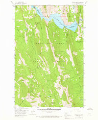
1958 Map of Patricks Basin
USGS Topo · Published 1966About this map
Lewis and Clark National Forest encompasses this high-altitude landscape of the northern Rocky Mountains as it was documented in the late 1950s. The geography is defined by prominent limestone features such as Black Reef and Windfall Reef, while the central hydrology is dominated by the Gibson Reservoir on the North Sun River. Human activity in this wilderness area is marked by the presence of the Klick Lower Ranch near the reservoir's spillway and several isolated structures like the Sheep Sheds situated along the high basins.
Find a feature on this map
43 named features on this map. Tap any name to fly to it.
Don’t see what you’re looking for? This feature index may not catch every label — zoom into the map to look around manually.
Map Details
Editions of this 1958 Patricks Basin Map
3 editions found
Other maps of this area

1903 · Saypo
USGS Topo · 1:125,000

1903 · Coopers Lake
USGS Topo · 1:125,000

1955 · Choteau
USGS Topo · 1:250,000

1957 · Choteau
USGS Topo · 1:250,000

1958 · Choteau
USGS Topo · 1:250,000

1958 · Sawtooth Ridge
USGS Topo · 1:24,000

1958 · Glenn Creek
USGS Topo · 1:24,000

1958 · Pretty Prairie
USGS Topo · 1:24,000

1958 · Patricks Basin
USGS Topo · 1:24,000

1958 · Castle Reef
USGS Topo · 1:24,000