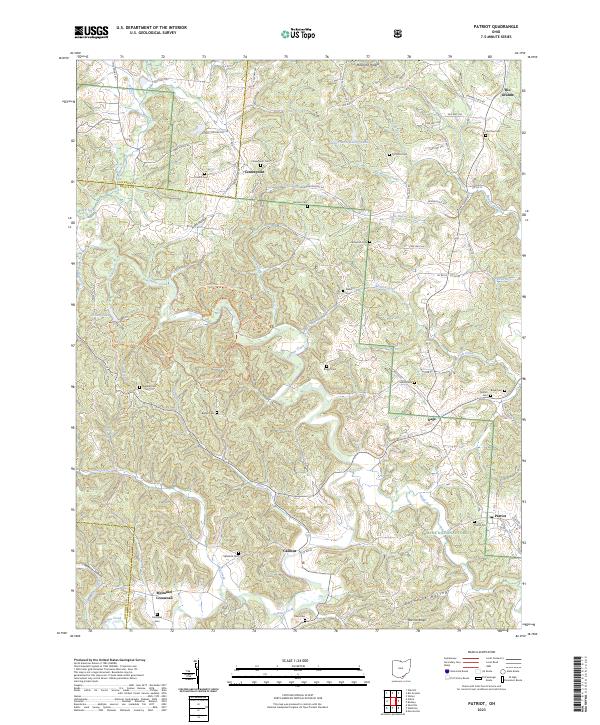
2023 Map of Patriot
USGS Topo · Published 2023About this map
Symmes Creek winds through a landscape of deep hollows and narrow ridges in southern Ohio, anchoring a network of small rural crossroads and family cemeteries. This 2023 survey of the Gallia County area captures long-standing communities like Patriot, Centerpoint, and Rio Grande as they exist today. The map reveals a high density of burial grounds, such as Centerpoint Cem and Wiseman Cem, which provide critical reference points for genealogists researching the families who settled this part of the Wayne National Forest. The rugged topography is defined by features like German Ridge and Burnette Hollow, while the Symmes Creek Trail-North Trl and Symmes Creek Trail-South Trl offer modern recreational access to the wooded interior. From McDaniel Crossroad in the south to the northern edges near Roush Run, the map documents a terrain where small-scale agriculture and forest land remain the dominant features.
Find a feature on this map
86 named features on this map. Tap any name to fly to it.
Don’t see what you’re looking for? This feature index may not catch every label — zoom into the map to look around manually.
Map Details
Editions of this 2023 Patriot Map
This is the sole edition of this map. No revisions or reprints were ever made.
Other maps of this area

1898 · Ironton
USGS Topo · 1:62,500

1900 · Ironton
USGS Topo · 1:62,500

1906 · Bidwell
USGS Topo · 1:62,500

1906 · Athalia
USGS Topo · 1:62,500

1908 · Bidwell
USGS Topo · 1:62,500

1908 · Athalia
USGS Topo · 1:62,500

1912 · Oak Hill
USGS Topo · 1:62,500

1957 · Huntington
USGS Topo · 1:250,000

1960 · Huntington
USGS Topo · 1:250,000
1961 · Oak Hill
USGS Topo · 1:24,000