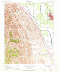
1953 Map of Patterson
USGS Topo · Published 1972About this map
Patterson serves as the hub of this Central Valley landscape, where the flat, productive agricultural lands of the Stanislaus County floor meet the rising elevations of the Diablo Range. The map illustrates a complex water management system essential to the region's mid-century growth, featuring the massive California Aqueduct and the Delta-Mendota Canal slicing across the valley floor. Within the town grid, civic life is centered around City Hall, North Mead Sch, and High School. To the west, the terrain shifts dramatically into Del Puerto Canyon and Black Gulch, where the Del Puerto Fire Control Sta monitors the transition from orchard rows to steep canyons. This 1971 revision also documents the industrial presence of the Southern Pacific railroad and the Patterson Airport, which facilitated the movement of goods and people during this era of California's agricultural expansion.
Find a feature on this map
35 named features on this map. Tap any name to fly to it.
Don’t see what you’re looking for? This feature index may not catch every label — zoom into the map to look around manually.
Map Details
Editions of this 1953 Patterson Map
4 editions found
Other maps of this area

1913 · Romain
USGS Topo · 1:31,680

1915 · Westport
USGS Topo · 1:31,680

1915 · Westley
USGS Topo · 1:31,680

1916 · Crows Landing
USGS Topo · 1:31,680

1916 · Patterson
USGS Topo · 1:31,680

1916 · Romain
USGS Topo · 1:31,680

1917 · Newman
USGS Topo · 1:31,680

1919 · Orestimba
USGS Topo · 1:62,500

1919 · Orestimba Creek
USGS Topo · 1:31,680

1922 · Carbona
USGS Topo · 1:62,500