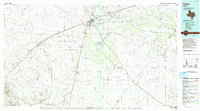
1986 Map of Pecos
USGS Topo · Published 1986About this map
The Pecos Valley landscape of the mid-1980s is defined by its deep arroyos and the complex industrial infrastructure of the Permian Basin. The regional hub of Pecos serves as the focal point, situated near the Pecos River and the junction of major transit lines like the Atchison Topeka and Santa Fe railroad. Outside the main town, smaller settlements such as Barstow, Toyah, and Verhalen dot the landscape, often positioned along the rail corridors that historically supported the cattle and cotton industries. The desert terrain is etched with numerous named draws, including Salt Draw and Toyah Creek, which channel seasonal runoff toward the river. To the south and east, the map reveals the extensive reach of the regional energy sector, notably within the Toro Gas Field and Waha Oil Field. A sprawling Automotive Proving Ground occupies a significant portion of the eastern plains, while smaller landmarks like Mount Evergreen Cem offer points of interest for genealogists tracing local family roots.
Find a feature on this map
71 named features on this map. Tap any name to fly to it.
Don’t see what you’re looking for? This feature index may not catch every label — zoom into the map to look around manually.
Map Details
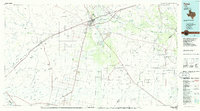
Editions of this 1986 Pecos Map
2 editions found