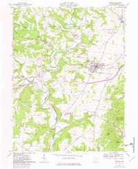
1961 Map of Peebles
USGS Topo · Published 1982About this map
Ohio Brush Creek and its many tributaries, including Shimer Run and Plum Run, carve through this landscape of southern Ohio. The village of Peebles serves as the central hub, situated along the Norfolk and Western railway which facilitated the local timber and industrial economy. Evidence of earlier industry is found at Marble Furnace, while the Quarry and a Pumping Station reflect mid-century utility.
Find a feature on this map
41 named features on this map. Tap any name to fly to it.
Don’t see what you’re looking for? This feature index may not catch every label — zoom into the map to look around manually.
Map Details
Editions of this 1961 Peebles Map
4 editions found
Other maps of this area

1915 · Bainbridge
USGS Topo · 1:48,000

1916 · Peebles
USGS Topo · 1:62,500

1917 · Bainbridge
USGS Topo · 1:62,500

1917 · Hillsboro
USGS Topo · 1:62,500

1918 · Peebles
USGS Topo · 1:62,500

1918 · Seaman
USGS Topo · 1:62,500

1944 · Hillsboro
USGS Topo · 1:62,500

1947 · Columbus
USGS Topo · 1:250,000

1957 · Huntington
USGS Topo · 1:250,000

1960 · Huntington
USGS Topo · 1:250,000