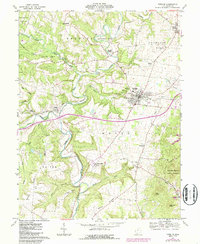
1961 Map of Peebles
USGS Topo · Published 1987About this map
Peebles serves as the central hub of this Adams County landscape, situated along the Norfolk and Western railroad corridor. The terrain is defined by the winding paths of the West Fork Ohio Brush Creek and its many tributaries, creating a complex series of ridges such as Spoon Ridge and Hoop Ridge. Small communities like Lawshe and Jacksonville dot the valleys, while Marble Furnace hints at the industrial history of the region.
Find a feature on this map
40 named features on this map. Tap any name to fly to it.
Don’t see what you’re looking for? This feature index may not catch every label — zoom into the map to look around manually.
Map Details
Editions of this 1961 Peebles Map
4 editions found
Other maps of this area

1915 · Bainbridge
USGS Topo · 1:48,000

1916 · Peebles
USGS Topo · 1:62,500

1917 · Bainbridge
USGS Topo · 1:62,500

1917 · Hillsboro
USGS Topo · 1:62,500

1918 · Peebles
USGS Topo · 1:62,500

1918 · Seaman
USGS Topo · 1:62,500

1944 · Hillsboro
USGS Topo · 1:62,500

1947 · Columbus
USGS Topo · 1:250,000

1957 · Huntington
USGS Topo · 1:250,000

1960 · Huntington
USGS Topo · 1:250,000