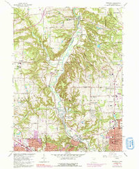
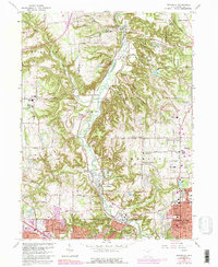
1963 Map of Peninsula
USGS Topo · Published 1992About this map
The Cuyahoga River carves a deep, winding valley through this landscape, flanked by the historic Ohio and Erie Canal and the Baltimore and Ohio Railroad. The rugged terrain of the Boston Ledges and Ritchie Ledges provides a stark contrast to the growing residential footprints of Cuyahoga Falls and Fairlawn in the south. The 1963 survey captures a transition in land use, where established rural communities like Peninsula and Everett are increasingly surrounded by conservation areas like Sand Run Metropolitan Park and Virginia Kendall Park. Genealogists will find several burial grounds mapped, including Chestnut Memorial Cemetery and the Ira Cem, while local historians can trace the industrial corridor near the Akron Sewage Disposal and various gravel pits that once supported regional development.
Find a feature on this map
78 named features on this map. Tap any name to fly to it.
Don’t see what you’re looking for? This feature index may not catch every label — zoom into the map to look around manually.
Map Details
Editions of this 1963 Peninsula Map
5 editions found
Other maps of this area

1903 · Cleveland
USGS Topo · 1:62,500

1903 · Akron
USGS Topo · 1:62,500

1905 · Akron
USGS Topo · 1:62,500

1906 · Kent
USGS Topo · 1:62,500

1906 · Chagrin Falls
USGS Topo · 1:62,500

1908 · Chagrin Falls
USGS Topo · 1:62,500

1950 · Cleveland
USGS Topo · 1:250,000

1953 · Broadview Heights
USGS Topo · 1:24,000

1953 · Twinsburg
USGS Topo · 1:24,000
1953 · Northfield
USGS Topo · 1:24,000