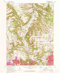
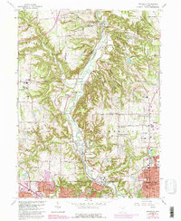
1963 Map of Peninsula
USGS Topo · Published 1967About this map
The Cuyahoga River carves a deep valley through the center of this map, flanked by the steep relief of the Boston Ledges and Ritchie Ledges. The landscape reflects a historic corridor of transportation, where the Ohio and Erie Canal and the Baltimore and Ohio railroad run parallel to the river. Small settlements like Peninsula, Everett, and Ira are situated along this route, while the southern margin shows the post-war urban expansion of Akron, Cuyahoga Falls, and Fairlawn.
Find a feature on this map
87 named features on this map. Tap any name to fly to it.
Don’t see what you’re looking for? This feature index may not catch every label — zoom into the map to look around manually.
Map Details
Editions of this 1963 Peninsula Map
5 editions found
Other maps of this area

1903 · Cleveland
USGS Topo · 1:62,500

1903 · Akron
USGS Topo · 1:62,500

1905 · Akron
USGS Topo · 1:62,500

1906 · Kent
USGS Topo · 1:62,500

1906 · Chagrin Falls
USGS Topo · 1:62,500

1908 · Chagrin Falls
USGS Topo · 1:62,500

1950 · Cleveland
USGS Topo · 1:250,000

1953 · Broadview Heights
USGS Topo · 1:24,000

1953 · Twinsburg
USGS Topo · 1:24,000
1953 · Northfield
USGS Topo · 1:24,000