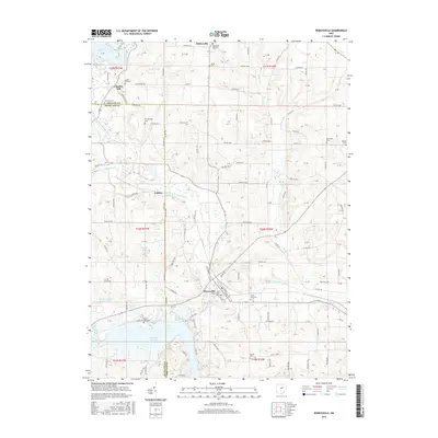
2016 Map of Perrysville
USGS Topo · Published 2016About this map
Perrysville stands as a central hub in Green Township, situated along the Black Fork Mohican River where the valley floor widens south of Widowville. The landscape is defined by its numerous small burial grounds, many of which carry family names like Shambaugh Cem, McFall Cem, and Peterson Cem, suggesting a long-established rural community with deep roots in both Ashland and Richland counties. The western edge is heavily marked by the Black Fork Mohican River and its tributaries, including Rocky Fork and Honey Cr, which flow through the agricultural hills. To the south and northwest, the presence of Pleasant Hill Lake and Charles Mill Lake indicates a territory significantly shaped by mid-century water management and recreation. Historic settlement patterns remain visible through established crossroads like Coulter and institutional landmarks such as Old Presbyterian Cem and Saint John Cem.
Find a feature on this map
102 named features on this map. Tap any name to fly to it.
Don’t see what you’re looking for? This feature index may not catch every label — zoom into the map to look around manually.
Map Details
Editions of this 2016 Perrysville Map
This is the sole edition of this map. No revisions or reprints were ever made.
Other maps of this area

1906 · West Salem
USGS Topo · 1:62,500

1908 · Ashland
USGS Topo · 1:62,500

1908 · West Salem
USGS Topo · 1:62,500

1912 · Loudonville
USGS Topo · 1:62,500

1912 · Perrysville
USGS Topo · 1:62,500

1914 · Loudonville
USGS Topo · 1:62,500

1915 · Perrysville
USGS Topo · 1:62,500

1943 · Loudonville
USGS Topo · 1:62,500

1944 · Perrysville
USGS Topo · 1:62,500

1950 · Marion
USGS Topo · 1:250,000