Loading...
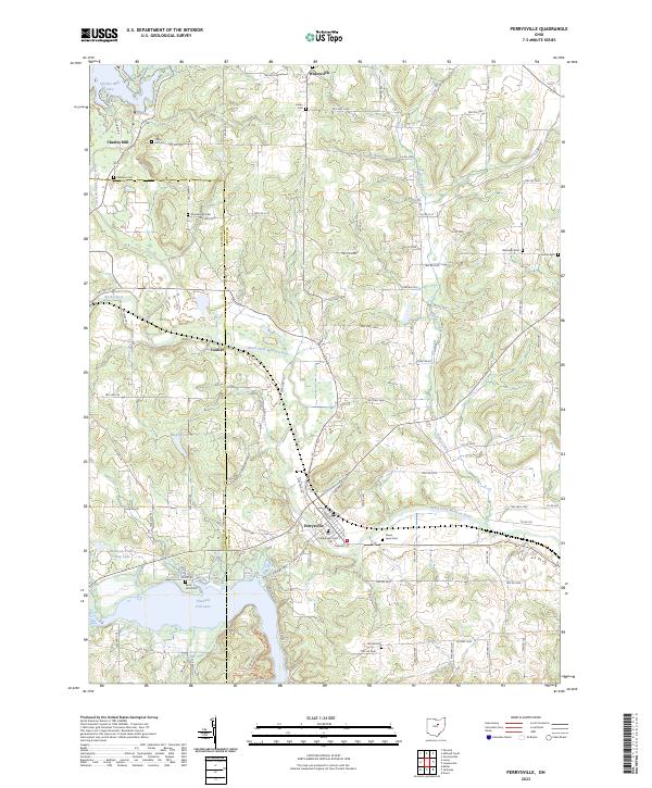
Loading map...2023 Map of Perrysville
USGS Topo · Published 2023About this map
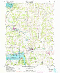
Perrysville sits at the heart of this landscape, positioned along the Black Fork Mohican River just north of the expansive Pleasant Hill Lake. The area reflects a deeply rooted rural community, defined by a dense network of country roads and family-named landmarks. The terrain is marked by significant hydrography, including the winding Honey Creek and Charles Mill Lake in the northwest.
Find a feature on this map
99 named features on this map. Tap any name to fly to it.
Don’t see what you’re looking for? This feature index may not catch every label — zoom into the map to look around manually.
Map Details
Date Portrayed2023
Date Published2023
PublisherU.S. Geological Survey
Map TypeTopographic
Scale1:24000
Physical Dimensions24 x 29 inches
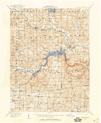
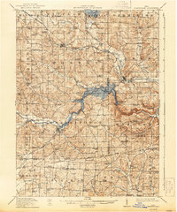
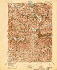
Editions of this 2023 Perrysville Map
This is the sole edition of this map. No revisions or reprints were ever made.
Historical Maps of Widowville Through Time
5 maps found
Featured Locations
- Green Township, OH
- Monroe Township, OH
- Worthington Township, OH
- Charles Mill, Mifflin Township
- Perrysville, Green Township
Source Details
SourceU.S. Geological Survey
CopyrightPublic Domain