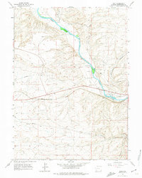
1961 Map of Peru
USGS Topo · Published 1974About this map
The Union Pacific railroad corridor serves as the industrial spine of this high-desert landscape, following the southern banks of the Green River. Along these tracks, small railroad-tied settlements and sidings like Peru and James Town appear near the river's bend, while Riovista and Riview cluster further east. The map records a transition from traditional livestock operations at Shaul Ranch and Gaensslen Ranch to modern infrastructure, including the Igo Airfield and various Gravel Pits that supported regional development. The rugged topography is defined by the Blue Rim to the north and the deep incision of Greasewood Canyon to the south. Historically significant travel ways are preserved here, most notably the path of the Overland Trail and the remote Telephone Road, which cut through the sagebrush-dominated terrain of Sweetwater County during the mid-twentieth century.
Find a feature on this map
23 named features on this map. Tap any name to fly to it.
Don’t see what you’re looking for? This feature index may not catch every label — zoom into the map to look around manually.
Map Details
Editions of this 1961 Peru Map
3 editions found
Other maps of this area

1954 · Rock Springs
USGS Topo · 1:250,000

1957 · Mc Kinnon Junction
USGS Topo · 1:62,500

1957 · Firehole Basin
USGS Topo · 1:62,500

1958 · Rock Springs
USGS Topo · 1:250,000

1961 · Scott Spring
USGS Topo · 1:24,000

1961 · Peru
USGS Topo · 1:24,000

1961 · Austin Ranch
USGS Topo · 1:24,000

1961 · Stevens Flat
USGS Topo · 1:24,000

1961 · Green River
USGS Topo · 1:24,000

1961 · Bryan
USGS Topo · 1:24,000