1952 Map of Peters
USGS Topo · Published 1994About this map
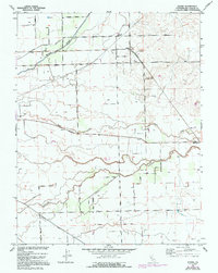
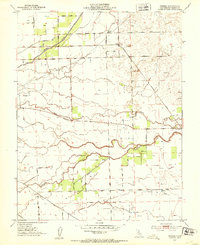
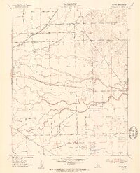
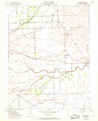
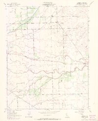
Mormon Slough and Duck Creek carve through this agricultural landscape in the San Joaquin Valley, reflecting the complex water management essential to the region's mid-century development. This 1952 plane-table survey, updated with 1968 aerial revisions, shows the rural community of Peters near the junction of the Stockton Terminal and Eastern Railroad and Milton Road. The grid of the Mt Diablo Base Line organizes the terrain, where numerous wells and pumps support the surrounding orchards and fields. To the south, the settlement of Farmington sits along Littlejohns Creek, near a small Cem and several Gravel Pits. Local landmarks like the Everett School and family-named routes such as Duncan Road and Murphy Road provide clear markers for genealogists tracing the 20th-century history of these Central Valley townships.
Find a feature on this map
34 named features on this map. Tap any name to fly to it.
Don’t see what you’re looking for? This feature index may not catch every label — zoom into the map to look around manually.
Map Details
Editions of this 1952 Peters Map
5 editions found
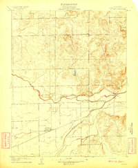
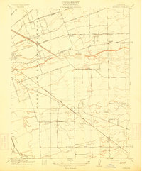
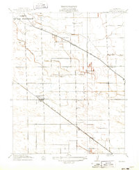
Other maps of this area

1889 · Jackson
USGS Topo · 1:125,000

1892 · Jackson
USGS Topo · 1:125,000

1894 · Lodi
USGS Topo · 1:125,000

1897 · Jackson
USGS Topo · 1:125,000

1902 · Jackson
USGS Topo · 1:125,000

1908 · Waterloo
USGS Topo · 1:31,680
1908 · Linden
USGS Topo · 1:31,680
1914 · Burnham
USGS Topo · 1:31,680
1914 · Manteca
USGS Topo · 1:31,680

1914 · Avena
USGS Topo · 1:31,680