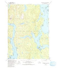
1949 Map of Petersburg A-4
USGS Topo · Published 1993About this map
Prince of Wales Island and the surrounding Alexander Archipelago waterways appear here in detail based on 1940s aerial surveys with 1980s updates. The landscape is defined by its complex maritime geography, where El Capitan Passage and Whale Passage carve through the heavily forested terrain of the Tongass National Forest. The presence of the North Whale Seaplane Base and the Camp Taylor (Site) on the western shore of the island highlights the era's reliance on air and water transport for remote coastal operations.
Find a feature on this map
34 named features on this map. Tap any name to fly to it.
Don’t see what you’re looking for? This feature index may not catch every label — zoom into the map to look around manually.
Map Details
Editions of this 1949 Petersburg A-4 Map
3 editions found
Other maps of this area

1948 · Petersburg B-3
USGS Topo · 1:63,360

1949 · Craig D-3
USGS Topo · 1:63,360

1949 · Petersburg B-5
USGS Topo · 1:63,360

1949 · Petersburg A-3
USGS Topo · 1:63,360

1949 · Craig D-4
USGS Topo · 1:63,360

1949 · Petersburg A-5
USGS Topo · 1:63,360

1949 · Petersburg A-4
USGS Topo · 1:63,360

1949 · Petersburg B-4
USGS Topo · 1:63,360

1950 · Craig D-3
USGS Topo · 1:63,360

1951 · Craig D-5
USGS Topo · 1:63,360