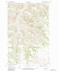
1974 Map of Petes Creek
USGS Topo · Published 1984About this map
The Killdeer Mountain State Game Management Area dominates the central high ground of this 1974 survey, covering a complex system of ridges and drainage basins. High-elevation divides dictate the flow of water through the region, notably the Eisenhower Divide, Bonnie Divide, and Dillinger Divide. These ridges separate numerous named watercourses including Petes Creek, Whitetail Creek, and Norred Creek to the north, while Oak Gulch and Bob Charlie Creek carve into the southern terrain. Evidence of local land use is found in the scattered Gravel Pit sites and a Scoria Pit, reflecting the area's geological utility. The map also records a single Grave south of the Rhodes terrain feature, providing a specific point of interest for genealogical researchers working in this part of Dunn County.
Find a feature on this map
17 named features on this map. Tap any name to fly to it.
Don’t see what you’re looking for? This feature index may not catch every label — zoom into the map to look around manually.
Map Details
Editions of this 1974 Petes Creek Map
2 editions found
Other maps of this area

1953 · Watford City
USGS Topo · 1:250,000

1957 · Watford City
USGS Topo · 1:250,000

1958 · Lone Butte SE
USGS Topo · 1:24,000

1958 · Lone Butte
USGS Topo · 1:24,000

1958 · North Killdeer Mountain
USGS Topo · 1:24,000

1967 · Watford City
USGS Topo · 1:250,000

1974 · Killdeer
USGS Topo · 1:100,000

1974 · Grassy Butte SW
USGS Topo · 1:24,000

1974 · Petes Creek
USGS Topo · 1:24,000

1974 · Fayette
USGS Topo · 1:24,000