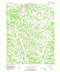
1954 Map of Petroleum
USGS Topo · Published 1982About this map
The northern edge of Scottsville and the winding basin of Trammel Creek dominate this 1950s landscape along the Kentucky-Tennessee border. The presence of numerous Oil Wells scattered across the ridges north of Petroleum speaks to the region's mid-century mineral extraction, while the surrounding terrain is punctuated by a dense network of country churches and rural schoolhouses. Places like Barefoot and Amos anchor the southern reaches, highlighting small-scale settlements along the county lines of Allen, Macon, and Sumner.
Find a feature on this map
54 named features on this map. Tap any name to fly to it.
Don’t see what you’re looking for? This feature index may not catch every label — zoom into the map to look around manually.
Map Details
Editions of this 1954 Petroleum Map
4 editions found
Other maps of this area

1921 · Bowling Green
USGS Topo · 1:62,500

1923 · Bowling Green
USGS Topo · 1:62,500

1926 · Scottsville
USGS Topo · 1:62,500

1928 · Adolphus
USGS Topo · 1:48,000

1931 · Lafayette
USGS Topo · 1:62,500

1931 · Adolphus
USGS Topo · 1:62,500

1942 · Gallatin
USGS Topo · 1:100,000

1954 · Austin
USGS Topo · 1:24,000

1954 · Petroleum
USGS Topo · 1:24,000

1954 · Scottsville
USGS Topo · 1:24,000