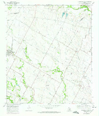
1968 Map of Pflugerville East
USGS Topo · Published 1975About this map
Pflugerville and the small agricultural communities of eastern Travis County appear here during a period of steady rural character just before the massive suburban expansion of the late 20th century. The landscape is defined by the headwaters of Wilbarger Creek and Gilleland Creek, with the Missouri Kansas Texas railroad line cutting through the western edge of the quadrangle. Significant cultural landmarks like Germania Hall and Richland Ch anchor the local social geography between family-named thoroughfares such as Priem Lane and Bohls Road.
Find a feature on this map
46 named features on this map. Tap any name to fly to it.
Don’t see what you’re looking for? This feature index may not catch every label — zoom into the map to look around manually.
Map Details
Editions of this 1968 Pflugerville East Map
3 editions found
Other maps of this area

1885 · Taylor
USGS Topo · 1:125,000

1885 · Bastrop
USGS Topo · 1:125,000

1887 · Taylor
USGS Topo · 1:125,000

1893 · Georgetown
USGS Topo · 1:125,000

1893 · Bastrop
USGS Topo · 1:125,000

1894 · Taylor
USGS Topo · 1:125,000

1896 · Austin
USGS Topo · 1:125,000

1897 · Austin
USGS Topo · 1:125,000

1904 · Bastrop
USGS Topo · 1:125,000

1910 · Austin
USGS Topo · 1:125,000