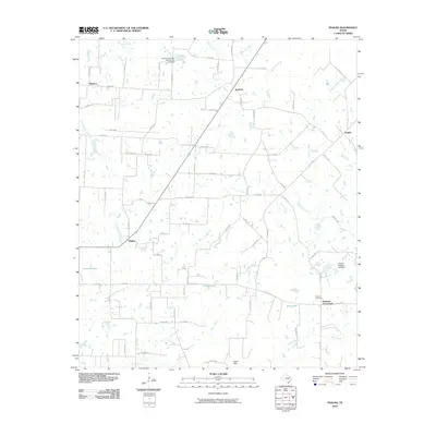
2010 Map of Phalba
USGS Topo · Published 2010About this map
Phalba and Denman Crossroads serve as central points in this portion of Van Zandt County, where a network of county roads connects rural homesteads and agricultural land. The landscape is defined by the branching tributaries of the Sabine River basin, including North Twin Creek, Steve Creek, and Wet Lacy Fork. These watercourses feed into several local bodies of water such as Pollard Lake and Bush Lake, while the Charles Napper Lake Dam indicates 21st-century water management in the region.
Find a feature on this map
68 named features on this map. Tap any name to fly to it.
Don’t see what you’re looking for? This feature index may not catch every label — zoom into the map to look around manually.
Map Details
Editions of this 2010 Phalba Map
This is the sole edition of this map. No revisions or reprints were ever made.
Other maps of this area

1920 · Kemp
USGS Topo · 1:62,500

1948 · Martins Mill
USGS Topo · 1:62,500

1949 · Martins Mill
USGS Topo · 1:62,500

1954 · Dallas
USGS Topo · 1:250,000

1956 · Tyler
USGS Topo · 1:250,000

1957 · Kemp
USGS Topo · 1:62,500

1958 · Dallas
USGS Topo · 1:250,000

1960 · Mabank
USGS Topo · 1:24,000

1962 · Myrtle Springs
USGS Topo · 1:24,000

1962 · Prairieville
USGS Topo · 1:24,000