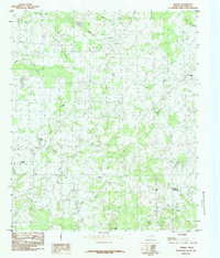
1984 Map of Phalba
USGS Topo · Published 1984About this map
Phalba and several small rural crossroads define this section of Van Zandt County during the late 1970s and early 1980s. The landscape is deeply etched by a network of seasonal and perennial waterways, including the winding paths of Wet Lacy Fork, Purtis Creek, and the meeting of North Twin Creek and South Twin Creek. Local life at this time centered around scattered settlements like Jackson, Whitton, and Tundra, where farm-to-market roads connected isolated homesteads. Small bodies of water such as Lake Phalba, Pollard Lake, and Andrews Lake are prominent landmarks within the drainage basins. The terrain is relatively low-lying, with Sand Hill rising as a notable elevation point in the south. This survey documents the rural character of the region before the expansion of local reservoirs and modern infrastructure altered the drainage patterns of these many creek branches.
Find a feature on this map
20 named features on this map. Tap any name to fly to it.
Don’t see what you’re looking for? This feature index may not catch every label — zoom into the map to look around manually.
Map Details
Editions of this 1984 Phalba Map
This is the sole edition of this map. No revisions or reprints were ever made.
Other maps of this area

1920 · Kemp
USGS Topo · 1:62,500

1948 · Martins Mill
USGS Topo · 1:62,500

1949 · Martins Mill
USGS Topo · 1:62,500

1954 · Dallas
USGS Topo · 1:250,000

1956 · Tyler
USGS Topo · 1:250,000

1957 · Kemp
USGS Topo · 1:62,500

1958 · Dallas
USGS Topo · 1:250,000

1960 · Mabank
USGS Topo · 1:24,000

1962 · Myrtle Springs
USGS Topo · 1:24,000

1962 · Prairieville
USGS Topo · 1:24,000