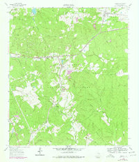
1960 Map of Phelps
USGS Topo · Published 1978About this map
The Sam Houston National Forest landscape is defined by the heavy timber and winding waterways of east Texas, where the Missouri Pacific railroad cuts a vital corridor through the woods. Settled communities like Phelps and Dodge serve as anchors in a region where several earlier locations are noted only by their historical footprints, including the Mt Moriah (Site) and Harmony (Site). The presence of the State Prison Farm (Wynne) in the southwest corner and scattered oil wells across the terrain illustrate the varied land use of Walker County during this era.
Find a feature on this map
47 named features on this map. Tap any name to fly to it.
Don’t see what you’re looking for? This feature index may not catch every label — zoom into the map to look around manually.
Map Details
Editions of this 1960 Phelps Map
3 editions found
Other maps of this area

1954 · Beaumont
USGS Topo · 1:250,000

1957 · Beaumont
USGS Topo · 1:250,000

1959 · Moore Grove
USGS Topo · 1:24,000

1960 · Maynard
USGS Topo · 1:24,000

1960 · New Waverly
USGS Topo · 1:24,000

1960 · Phelps
USGS Topo · 1:24,000

1961 · Staley
USGS Topo · 1:24,000

1961 · Riverside
USGS Topo · 1:24,000

1961 · Oakhurst
USGS Topo · 1:24,000

1962 · Pine Prairie
USGS Topo · 1:24,000