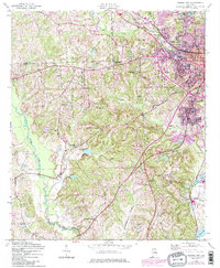
1955 Map of Phenix City
USGS Topo · Published 1984About this map
Phenix City serves as the urban anchor for this mid-century survey, revealing a landscape defined by the convergence of the Central of Georgia railroad and the winding paths of Cochgalechee Creek and Little Uchee Creek. The map documents the city's westward expansion toward Ladonia, while rural Lee and Russell counties remain dotted with namesake landmarks such as Woodland Ch, Uchee Hill Ch, and Friendship Ch Cem. Of particular interest to local historians is the Brickyard area in the southeast, where the industrial presence of the Brickyard Sch and various clay-associated labels suggest the local economy of the era. The mapping of Mother Mary Mission and several historically significant schools, including Carmichael Sch and Westside Sch, provides a detailed record of the community's social and educational infrastructure during a period of steady post-war development.
Find a feature on this map
41 named features on this map. Tap any name to fly to it.
Don’t see what you’re looking for? This feature index may not catch every label — zoom into the map to look around manually.
Map Details
Editions of this 1955 Phenix City Map
5 editions found

Other maps of this area

1907 · Talbotton
USGS Topo · 1:125,000

1907 · Opelika
USGS Topo · 1:125,000

1908 · Columbus
USGS Topo · 1:62,500

1909 · Opelika
USGS Topo · 1:125,000

1914 · Seale
USGS Topo · 1:62,500

1929 · Columbus
USGS Topo · 1:48,000

1947 · Columbus
USGS Topo · 1:62,500

1949 · Fort Mitchell
USGS Topo · 1:24,000

1949 · Columbus
USGS Topo · 1:24,000

1950 · Fort Benning
USGS Topo · 1:24,000