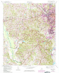
1955 Map of Phenix City
USGS Topo · Published 1984About this map
Phenix City anchors this 1955 survey of the Alabama-Georgia borderlands, showing the city's mid-century expansion along the Central of Georgia rail line. The landscape transitions from the urbanized streets around Memorial Hospital and Martin Stadium to the rural hills of the Lee Co and Russell Co border. These outlying areas are dotted with local landmarks like Hebee Hill and numerous community centers, including Woodland Ch, Hillside Chapel, and Bethlehem Ch.
Find a feature on this map
42 named features on this map. Tap any name to fly to it.
Don’t see what you’re looking for? This feature index may not catch every label — zoom into the map to look around manually.
Map Details
Editions of this 1955 Phenix City Map
5 editions found

Other maps of this area

1907 · Talbotton
USGS Topo · 1:125,000

1907 · Opelika
USGS Topo · 1:125,000

1908 · Columbus
USGS Topo · 1:62,500

1909 · Opelika
USGS Topo · 1:125,000

1914 · Seale
USGS Topo · 1:62,500

1929 · Columbus
USGS Topo · 1:48,000

1947 · Columbus
USGS Topo · 1:62,500

1949 · Fort Mitchell
USGS Topo · 1:24,000

1949 · Columbus
USGS Topo · 1:24,000

1950 · Fort Benning
USGS Topo · 1:24,000