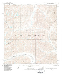
1971 Map of Philip Smith Mountains B-2
USGS Topo · Published 1988About this map
The Continental Divide snake across this 1971 survey, defining the hydrographic split of the Brooks Range where waters flow either toward the Arctic Ocean or south into the Yukon River drainage. Located within the Arctic National Wildlife Refuge, this map documents a vast, high-altitude landscape devoid of roads or permanent settlements. The northern reaches are characterized by the headwaters of Accomplishment Creek, while the southern slopes descend toward the Middle Fork Chandalar River. The terrain is a study in natural boundaries and elevation, captured via photogrammetric methods just before the decade that saw increased federal conservation designations in the Alaskan wilderness. The map provides a precise record of the original watercourses and topography in this corner of the North Slope Borough before more contemporary environmental shifts.
Find a feature on this map
4 named features on this map. Tap any name to fly to it.
Don’t see what you’re looking for? This feature index may not catch every label — zoom into the map to look around manually.
Map Details
Editions of this 1971 Philip Smith Mountains B-2 Map
2 editions found
Other maps of this area

1951 · Brooks
USGS Topo · 1:250,000

1956 · Philip Smith Mountains
USGS Topo · 1:250,000

1964 · Philip Smith Mountains
USGS Topo · 1:250,000
1971 · Philip Smith Mountains C-1
USGS Topo · 1:63,360
1971 · Philip Smith Mountains C-2
USGS Topo · 1:63,360
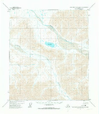
1971 · Philip Smith Mountains C-3
USGS Topo · 1:63,360
1971 · Philip Smith Mountains B-1
USGS Topo · 1:63,360
1971 · Philip Smith Mountains A-2
USGS Topo · 1:63,360
1971 · Philip Smith Mountains A-1
USGS Topo · 1:63,360

1971 · Philip Smith Mountains B-3
USGS Topo · 1:63,360