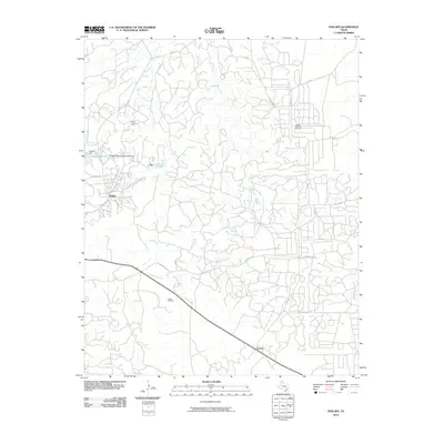
2010 Map of Phillips
USGS Topo · Published 2010About this map
Industrial infrastructure and petroleum extraction dominate this landscape north of the Canadian River in Hutchinson County. The settlement of Phillips and the nearby Texroy are surrounded by a complex network of ranch roads and oil field service routes, reflecting the region's long-standing connection to the energy sector. Vital water management and industrial facilities are evident through the Pantex Reservoir, Pantex Dam, and the Phillips Refinery Dam Number 1, which sit just north of the residential areas.
Find a feature on this map
27 named features on this map. Tap any name to fly to it.
Don’t see what you’re looking for? This feature index may not catch every label — zoom into the map to look around manually.
Map Details
Editions of this 2010 Phillips Map
This is the sole edition of this map. No revisions or reprints were ever made.
Other maps of this area

1953 · Plemons
USGS Topo · 1:24,000

1953 · Stinnett
USGS Topo · 1:24,000

1953 · Borger SE
USGS Topo · 1:24,000

1953 · McBride
USGS Topo · 1:24,000

1953 · Phillips
USGS Topo · 1:24,000

1953 · Borger
USGS Topo · 1:24,000

1954 · Amarillo
USGS Topo · 1:250,000

1958 · Amarillo
USGS Topo · 1:250,000

1963 · Skellytown
USGS Topo · 1:24,000

1970 · Borger
USGS Topo · 1:24,000