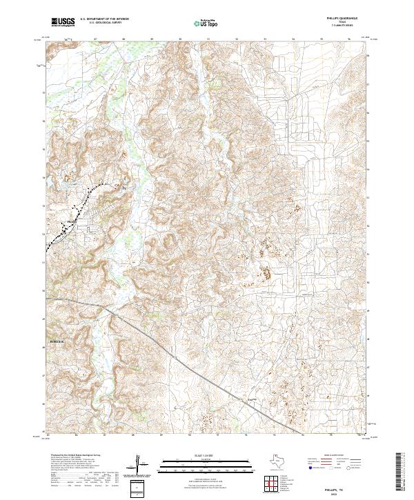
2022 Map of Phillips
USGS Topo · Published 2022About this map
Phillips and the northern edge of Borger occupy this stretch of the Texas Panhandle, defined by the winding course of the Canadian River and its tributary system. The industrial and hydraulic management of the area is evident through the Phillips Stormwater Control Reservoir Pantex Reservoir, a major feature situated west of the primary settlement. The landscape is deeply dissected by numerous drainages, most notably Dixon Cr and Bear Cr, which cut through the terrain toward the river valley to the north. A network of rural and secondary roads, including Smith-Capers Rd and Plemons Rd, connects the residential clusters with the outlying plains. This 2022 survey captures the contemporary footprint of Texroy and the established infrastructure surrounding the local water resources and transport corridors.
Find a feature on this map
29 named features on this map. Tap any name to fly to it.
Don’t see what you’re looking for? This feature index may not catch every label — zoom into the map to look around manually.
Map Details
Editions of this 2022 Phillips Map
This is the sole edition of this map. No revisions or reprints were ever made.
Other maps of this area

1953 · Plemons
USGS Topo · 1:24,000

1953 · Stinnett
USGS Topo · 1:24,000

1953 · Borger SE
USGS Topo · 1:24,000

1953 · McBride
USGS Topo · 1:24,000

1953 · Phillips
USGS Topo · 1:24,000

1953 · Borger
USGS Topo · 1:24,000

1954 · Amarillo
USGS Topo · 1:250,000

1958 · Amarillo
USGS Topo · 1:250,000

1963 · Skellytown
USGS Topo · 1:24,000

1970 · Borger
USGS Topo · 1:24,000