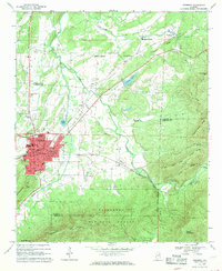
1967 Map of Piedmont
USGS Topo · Published 1969About this map
The manufacturing and transit hub of Piedmont occupies the center of this 1967 survey, where the Southern and Seaboard Coast Line railroads intersect near the foothills of Dugger Mountain. This area of Calhoun County reflects a landscape transition from the dense industrial and civic layout of the town—marked by the Hospital, Armory, and High Sch—to the agrarian and mountainous surrounds. Rural life is anchored by small crossroads like McFrey Crossroads and Spring Garden, with a high density of small country churches including Shady Grove Ch and Philadelphia Ch.
Find a feature on this map
59 named features on this map. Tap any name to fly to it.
Don’t see what you’re looking for? This feature index may not catch every label — zoom into the map to look around manually.
Map Details
Editions of this 1967 Piedmont Map
3 editions found
Other maps of this area

1886 · Rome
USGS Topo · 1:125,000

1889 · Tallapoosa
USGS Topo · 1:125,000

1892 · Tallapoosa
USGS Topo · 1:125,000

1893 · Fort Payne
USGS Topo · 1:125,000

1897 · Tallapoosa
USGS Topo · 1:125,000

1898 · Rome
USGS Topo · 1:125,000

1898 · Fort Payne
USGS Topo · 1:125,000

1899 · Rome
USGS Topo · 1:125,000

1900 · Fort Payne
USGS Topo · 1:125,000

1900 · Anniston
USGS Topo · 1:125,000