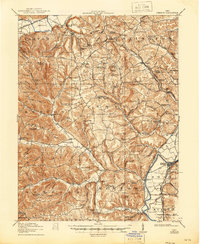
1917 Map of Piketon
USGS Topo · Published 1946About this map
The Scioto River valley serves as the primary corridor for commerce and settlement in this southern Ohio region during the early twentieth century. The village of Piketon anchors the eastern riverbank, while Jasper sits directly across the water. This area is notably characterized by its ancient earthworks, including the prominent Seip Mound near Paint Creek and the Mound Cemetery at the southern edge of the Piketon townsite. These features highlight the long human history of the Scioto valley, existing alongside modern infrastructure like the Norfolk and Western and the Detroit Toledo and Ironton RR.
Find a feature on this map
150 named features on this map. Tap any name to fly to it.
Don’t see what you’re looking for? This feature index may not catch every label — zoom into the map to look around manually.
Map Details
Editions of this 1917 Piketon Map
2 editions found

Other maps of this area

1906 · Waverly
USGS Topo · 1:62,500

1906 · Chillicothe
USGS Topo · 1:62,500

1908 · Chillicothe
USGS Topo · 1:62,500

1908 · Waverly
USGS Topo · 1:62,500

1911 · Sciotoville
USGS Topo · 1:62,500

1912 · Roxabell
USGS Topo · 1:62,500

1913 · Sciotoville
USGS Topo · 1:62,500

1914 · Roxabell
USGS Topo · 1:62,500

1915 · Bainbridge
USGS Topo · 1:48,000

1915 · Otway
USGS Topo · 1:62,500