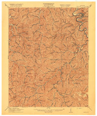
1916 Map of Pikeville
USGS Topo · Published 1916About this map
Pikeville serves as the focal point of this 1914 survey, situated along the winding Levisa Fork in a landscape defined by an incredibly dense network of schools and narrow creek valleys. The settlement pattern follows the drainage of Beaver Creek and Shelby Creek, where dozens of numbered rural schools, such as School No 25 and School No 151, dot the hollows. This suggests a highly decentralized but deeply rooted mountain community structure before modern consolidation.
Find a feature on this map
130 named features on this map. Tap any name to fly to it.
Don’t see what you’re looking for? This feature index may not catch every label — zoom into the map to look around manually.
Map Details
Editions of this 1916 Pikeville Map
5 editions found

Other maps of this area

1886 · Prestonsburg
USGS Topo · 1:125,000

1886 · Grundy
USGS Topo · 1:125,000

1887 · Warfield
USGS Topo · 1:125,000

1890 · Whitesburg
USGS Topo · 1:125,000

1890 · Grundy
USGS Topo · 1:125,000

1891 · Warfield
USGS Topo · 1:125,000

1892 · Grundy
USGS Topo · 1:125,000

1892 · Whitesburg
USGS Topo · 1:125,000

1892 · Prestonsburg
USGS Topo · 1:125,000

1912 · Pound
USGS Topo · 1:48,000