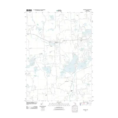
2011 Map of Pinckney
USGS Topo · Published 2011About this map
Pinckney and its surrounding glacial lakes define this southern Michigan landscape as it appeared in the early 21st century. The village center is anchored by the Pinckney Post Office and a cluster of local history markers, including Pinckney Cemetery and Saint Marys Cemetery. To the south, the terrain descends toward a complex network of waterways, where the Portage River connects Silver Lake, Little Portage Lake, and the expansive Portage Lake. This region shows a distinct transition from the residential street grids of Pinckney to the more eclectic settlement of Hell near the Hell Creek Ranch Campground.
Find a feature on this map
118 named features on this map. Tap any name to fly to it.
Don’t see what you’re looking for? This feature index may not catch every label — zoom into the map to look around manually.
Map Details
Editions of this 2011 Pinckney Map
This is the sole edition of this map. No revisions or reprints were ever made.
Other maps of this area

1902 · Dexter
USGS Topo · 1:62,500

1904 · Ann Arbor
USGS Topo · 1:125,000

1906 · Dexter
USGS Topo · 1:62,500

1907 · Howell
USGS Topo · 1:62,500

1908 · Ann Arbor
USGS Topo · 1:125,000

1908 · Fowlerville
USGS Topo · 1:62,500

1909 · Howell
USGS Topo · 1:62,500

1910 · Fowlerville
USGS Topo · 1:62,500

1919 · Stockbridge
USGS Topo · 1:62,500

1922 · Stockbridge
USGS Topo · 1:62,500
Featured Places
- Hamburg Township, MI
- Putnam Township, MI
- Webster Township, MI
- Dexter Township, MI
- Pinckney, Putnam Township