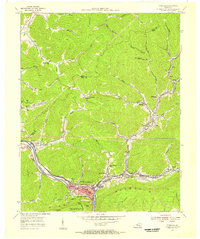
1954 Map of Pineville
USGS Topo · Published 1956About this map
Pineville sits at a strategic bend of the Cumberland River, where the historic Wilderness Road and the Louisville and Nashville railroad converge against the massive ridge of Pine Mountain. This mid-century survey illustrates the intense industrial and transportation activity of the era, with numerous strip mines, gas wells, and rail spurs threading through the narrow valleys. The map documents a dense network of local landmarks, including the County High Sch and distinctive geological features like Chain Rock and Lookout Rock within Pine Mountain State Park. Outside the main town, small mining and rail communities like Wallsend, Arjay, and Blanche follow the winding course of Straight Creek and Fourmile Creek. The landscape is a complex mix of rugged terrain and coal-era infrastructure, marked by numerous rural schools such as Elys Branch Sch and Moore Creek Sch.
Find a feature on this map
65 named features on this map. Tap any name to fly to it.
Don’t see what you’re looking for? This feature index may not catch every label — zoom into the map to look around manually.
Map Details
Editions of this 1954 Pineville Map
2 editions found
Other maps of this area

1886 · Cumberland Gap
USGS Topo · 1:125,000

1888 · Cumberland Gap
USGS Topo · 1:125,000

1891 · Cumberland Gap
USGS Topo · 1:125,000

1903 · Pineville
USGS Topo · 1:48,000

1903 · Middlesboro
USGS Topo · 1:48,000

1927 · Middlesboro
USGS Topo · 1:62,500

1930 · Middlesboro
USGS Topo · 1:62,500

1935 · Varilla
USGS Topo · 1:24,000

1952 · Fount
USGS Topo · 1:24,000
1952 · Artemus
USGS Topo · 1:24,000