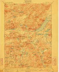
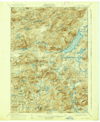
1906 Map of Piseco Lake
USGS Topo · Published 1910About this map
Piseco Lake dominates this Adirondack landscape at the opening of the twentieth century, serving as the central drainage for a network of high peaks and backcountry waterways. Small, isolated clearings and settlements like Rudeston and Hoffmeister anchor the few roads in the region, while remote locations such as Powley Place, Averys Place, and Shaker Place suggest a late frontier character defined by logging or seasonal travel. The southern portion of the sheet is marked by the Stratford Oregon Transit Line, a notable historical corridor cutting through the woods toward the hamlet of Oregon.
Find a feature on this map
119 named features on this map. Tap any name to fly to it.
Don’t see what you’re looking for? This feature index may not catch every label — zoom into the map to look around manually.
Map Details
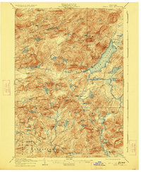
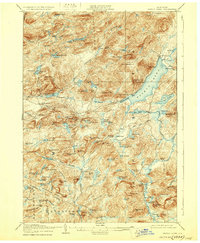
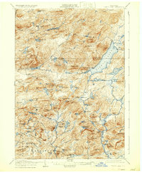
Editions of this 1906 Piseco Lake Map
7 editions found

Other maps of this area

1899 · Indian Lake
USGS Topo · 1:62,500

1900 · Little Falls
USGS Topo · 1:62,500

1900 · Canada Lake
USGS Topo · 1:62,500

1900 · Wilmurt
USGS Topo · 1:62,500

1901 · Old Forge
USGS Topo · 1:62,500

1901 · Lassellsville
USGS Topo · 1:62,500

1902 · Wilmurt
USGS Topo · 1:62,500

1902 · Indian Lake
USGS Topo · 1:62,500

1903 · West Canada Lakes
USGS Topo · 1:62,500

1903 · Gloversville
USGS Topo · 1:62,500