
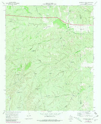
1968 Map of Pitchfork Ranch
USGS Topo · Published 1970About this map
Pitchfork Ranch anchors this West Texas landscape along the South Wichita River, revealing a ranching economy defined by its network of water infrastructure. In the late 1960s, the terrain across the Dickens County and King County line is remarkably sparse, with development limited to family-named landmarks and essential livestock wells. The map documents a rugged drainage system where Davidson Canyon and Water Canyon feed into the river valley, while Croton Creek and Salt Creek carve through the southern reaches. This survey is particularly useful for identifying specific ranching outposts like West Presley Windmill and James Hodge Windmill. The presence of the Radio Tower and numerous "Drill Hole" sites indicates the intersection of traditional land use with modern communications and resource exploration in this rolling prairie environment.
Find a feature on this map
40 named features on this map. Tap any name to fly to it.
Don’t see what you’re looking for? This feature index may not catch every label — zoom into the map to look around manually.
Map Details
Editions of this 1968 Pitchfork Ranch Map
2 editions found
Other maps of this area

1954 · Lubbock
USGS Topo · 1:250,000

1958 · Pursley House
USGS Topo · 1:24,000

1958 · Southerland Canyon
USGS Topo · 1:24,000

1959 · Gilpin
USGS Topo · 1:24,000

1967 · Guthrie NW
USGS Topo · 1:24,000

1968 · East Afton
USGS Topo · 1:24,000

1968 · Croton Camp
USGS Topo · 1:24,000

1968 · East Afton NE
USGS Topo · 1:24,000

1968 · Pitchfork Flats
USGS Topo · 1:24,000

1985 · Dickens
USGS Topo · 1:100,000