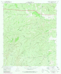
1968 Map of Pitchfork Ranch
USGS Topo · Published 1981About this map
Pitchfork Ranch anchors this portion of the Texas panhandle, where the South Wichita River and its seasonal tributaries carve a network of deep drainage canyons through the West Texas plains. The landscape is defined by the practical infrastructure of large-scale cattle ranching during the mid-twentieth century. A notable density of wind-powered water pumps, such as the James Hodge Windmill and Matador Windmill, reveals the reliance on groundwater in this arid terrain. The presence of Devils Playground Windmill and the T Fortyone Canyon suggests a complex topography that dictated the movement of livestock and the placement of remote ranch outposts. This 1968 survey, later updated with 1979 aerial data, captures the intersection of traditional land use and modern transit, as Highway 82 114 cuts across the northern canyons near Davidson Canyon.
Find a feature on this map
37 named features on this map. Tap any name to fly to it.
Don’t see what you’re looking for? This feature index may not catch every label — zoom into the map to look around manually.
Map Details
Editions of this 1968 Pitchfork Ranch Map
2 editions found
Other maps of this area

1954 · Lubbock
USGS Topo · 1:250,000

1958 · Pursley House
USGS Topo · 1:24,000

1958 · Southerland Canyon
USGS Topo · 1:24,000

1959 · Gilpin
USGS Topo · 1:24,000

1967 · Guthrie NW
USGS Topo · 1:24,000

1968 · East Afton
USGS Topo · 1:24,000

1968 · Pitchfork Ranch
USGS Topo · 1:24,000

1968 · Croton Camp
USGS Topo · 1:24,000

1968 · East Afton NE
USGS Topo · 1:24,000

1968 · Pitchfork Flats
USGS Topo · 1:24,000