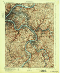
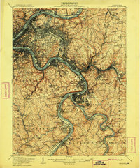
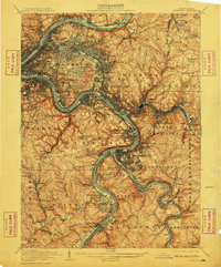
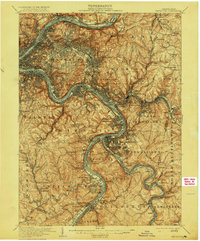
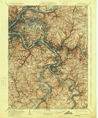
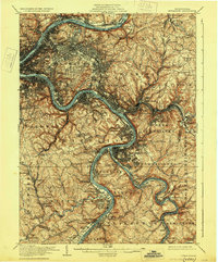
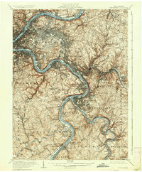
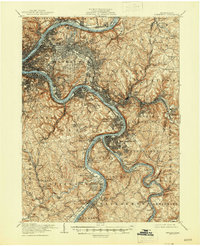
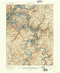
1907 Map of Pittsburgh
USGS Topo · Published 1932About this map
The Monongahela River and Allegheny River converge here to define the industrial heart of western Pennsylvania at the start of the 20th century. This survey, conducted shortly after the turn of the century, captures the dense urban core of Pittsburgh alongside the burgeoning mill towns of Homestead, Braddock, and Duquesne. The landscape is dominated by the intricate network of the Pennsylvania RR and the Baltimore and Ohio RR, which trace the riverbanks and narrow valleys to service the region's steel and manufacturing giants. Beyond the city, the map reveals the transition to outlying settlements like Wilkinsburg and Monroeville. Cultural landmarks such as Homewood Cem and Cockhams Mill sit alongside the winding Youghiogheny River, illustrating the complex social and industrial geography of McKeesport and its neighboring boroughs during a period of massive expansion.
Find a feature on this map
126 named features on this map. Tap any name to fly to it.
Don’t see what you’re looking for? This feature index may not catch every label — zoom into the map to look around manually.
Map Details
Editions of this 1907 Pittsburgh Map
10 editions found

Other maps of this area

1901 · Amity
USGS Topo · 1:62,500

1902 · Brownsville
USGS Topo · 1:62,500

1902 · Connellsville
USGS Topo · 1:62,500

1904 · Amity
USGS Topo · 1:62,500

1904 · Mc Keesport
USGS Topo · 1:62,500

1904 · Carnegie
USGS Topo · 1:62,500

1904 · Greensburg
USGS Topo · 1:62,500

1906 · Brownsville
USGS Topo · 1:62,500

1906 · Carnegie
USGS Topo · 1:62,500
1906 · Greensburg
USGS Topo · 1:62,500