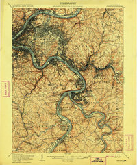
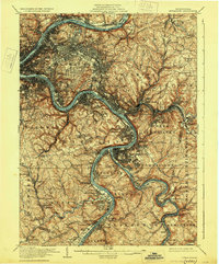
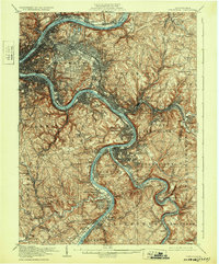
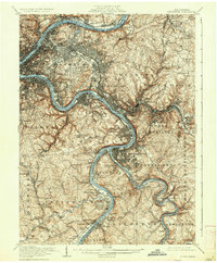
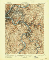
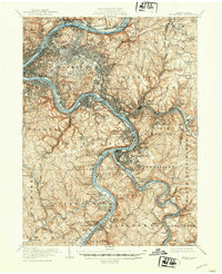
1907 Map of Pittsburg
USGS Topo · Published 1908About this map
The Monongahela River and Allegheny River converge to form the Ohio River at the heart of this industrial landscape during a period of massive steel and rail expansion. The survey detail shows the dense urban grid of Pittsburg extending eastward through Wilkinsburg and into the steel-making hubs of Homestead and Bessemer. Major green spaces such as Schenley Park and Highland Park are clearly delineated alongside significant burial grounds like Oakland Cem and Homewood Cem. The intricate rail network is a primary focus, documenting the routes of the Pennsylvania RR, the Baltimore and Ohio RR, and the Pittsburg and Lake Erie RR as they follow the riverbanks and cut through the steep topography of Mifflin and Wilkins townships. Smaller communities such as Turtle Creek, Pitcairn, and Wilmerding are visible along the eastern industrial corridors.
Find a feature on this map
148 named features on this map. Tap any name to fly to it.
Don’t see what you’re looking for? This feature index may not catch every label — zoom into the map to look around manually.
Map Details
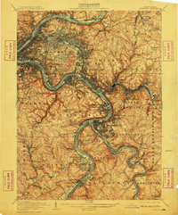
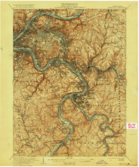
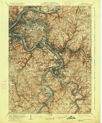
Editions of this 1907 Pittsburg Map
10 editions found

Other maps of this area

1901 · Amity
USGS Topo · 1:62,500

1902 · Brownsville
USGS Topo · 1:62,500

1902 · Connellsville
USGS Topo · 1:62,500

1904 · Amity
USGS Topo · 1:62,500

1904 · Mc Keesport
USGS Topo · 1:62,500

1904 · Carnegie
USGS Topo · 1:62,500

1904 · Greensburg
USGS Topo · 1:62,500

1906 · Brownsville
USGS Topo · 1:62,500

1906 · Carnegie
USGS Topo · 1:62,500
1906 · Greensburg
USGS Topo · 1:62,500