Loading...
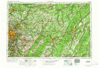
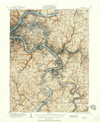
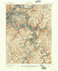
Loading map...1958 Map of Pittsburgh
USGS Topo · Published 1966About this map
The confluence of the Allegheny River and Monongahela River forms the Ohio River at Pittsburgh, the industrial heart of this regional study. Revised through the mid-1960s, this map documents the dense urban core and its expansion along the river valleys into New Kensington, McKeesport, and Wilkinsburg. To the east, the terrain transforms as the Allegheny Mountains rise, showing the structural dominance of Laurel Hill and Chestnut Ridge.
Find a feature on this map
73 named features on this map. Tap any name to fly to it.
Don’t see what you’re looking for? This feature index may not catch every label — zoom into the map to look around manually.
Map Details
Date Portrayed1958
Date Published1966
PublisherU.S. Geological Survey
Map TypeTopographic
Scale1:250,000
Physical Dimensions32.2 x 22.2 inches
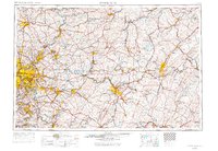
Editions of this 1958 Pittsburgh Map
5 editions found

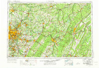
Historical Maps of Pittsburgh Through Time
7 maps found


Featured Locations
Source Details
SourceU.S. Geological Survey
CopyrightPublic Domain