
1958 Map of Pittsburgh
USGS Topo · Published 1958About this map
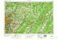
The Allegheny River and Monongahela River converge at the heart of industrial Pittsburgh, anchoring a dense network of river-and-rail infrastructure in the late 1950s. This survey illustrates the mid-century industrial footprint of Western Pennsylvania, where the Pennsylvania RR and Baltimore and Ohio RR connect major manufacturing centers like McKeesport, Johnstown, and Altoona. Beyond the urban cores, the landscape is defined by the sharp ridges of the Allegheny Front and the Pennsylvania Turnpike cutting across the terrain toward the east.
Find a feature on this map
120 named features on this map. Tap any name to fly to it.
Don’t see what you’re looking for? This feature index may not catch every label — zoom into the map to look around manually.
Map Details
Editions of this 1958 Pittsburgh Map
5 editions found
Other maps of this area

1900 · Uniontown
USGS Topo · 1:62,500

1900 · Mercersburg
USGS Topo · 1:62,500

1900 · Masontown
USGS Topo · 1:62,500

1900 · Latrobe
USGS Topo · 1:62,500

1900 · Everett
USGS Topo · 1:62,500

1900 · Kittanning
USGS Topo · 1:62,500

1901 · Amity
USGS Topo · 1:62,500

1901 · Rural Valley
USGS Topo · 1:62,500

1901 · Waynesburg
USGS Topo · 1:62,500

1901 · Huntingdon
USGS Topo · 1:62,500