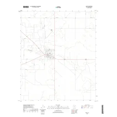
2019 Map of Plains
USGS Topo · Published 2019About this map
Plains serves as the focal point of this West Texas landscape, situated at a major crossroads in the High Plains. The town's grid is clearly defined, featuring a mix of numbered streets and named avenues like Ferrel Ave and Poplar Ave. A notable local landmark is the Po, located near the center of the settlement. To the north, the Yoakum County Airport indicates the region's reliance on air travel to navigate the wide distances of the Llano Estacado.
Find a feature on this map
39 named features on this map. Tap any name to fly to it.
Don’t see what you’re looking for? This feature index may not catch every label — zoom into the map to look around manually.
Map Details
Editions of this 2019 Plains Map
This is the sole edition of this map. No revisions or reprints were ever made.
Other maps of this area

1954 · Brownfield
USGS Topo · 1:250,000

1958 · Brownfield
USGS Topo · 1:250,000

1962 · Brownfield
USGS Topo · 1:250,000

1970 · Plains 1 SW
USGS Topo · 1:24,000

1970 · Tokio NW
USGS Topo · 1:24,000

1970 · Pleasant Hill
USGS Topo · 1:24,000

1971 · Plains NW
USGS Topo · 1:24,000
1971 · Ink Basin
USGS Topo · 1:24,000
1971 · Plains SE
USGS Topo · 1:24,000
1971 · Plains
USGS Topo · 1:24,000