
1955 Map of Plant City
USGS Topo · Published 1966About this map
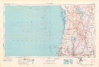
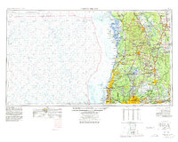
The coastal wetlands and inland citrus corridors of mid-century Central Florida are documented here through the mid-1960s. Along the Gulf of Mexico, the landscape is defined by the intricate salt marshes and keys of the Chassahowitzka National Wildlife Refuge and the Anclote National Wildlife Refuge, where the Anclote Keys Lighthouse stands as a sentinel over the sound. Inland, a dense network of freshwater lakes, including Lake Thonotosassa and Lake Panasoffkee, punctuates the terrain between the Withlacoochee River and the Hillsborough River.
Find a feature on this map
126 named features on this map. Tap any name to fly to it.
Don’t see what you’re looking for? This feature index may not catch every label — zoom into the map to look around manually.
Map Details
Editions of this 1955 Plant City Map
6 editions found
Other maps of this area

1892 · Dunnellon
USGS Topo · 1:62,500

1893 · Panasoffkee
USGS Topo · 1:62,500

1894 · Dunnellon
USGS Topo · 1:62,500

1895 · Tsala Apopka
USGS Topo · 1:62,500

1895 · Panasoffkee
USGS Topo · 1:62,500

1895 · Ocala
USGS Topo · 1:62,500

1921 · Sand Key
USGS Topo · 1:62,500

1921 · Tampa
USGS Topo · 1:62,500

1921 · St Petersburg
USGS Topo · 1:62,500

1943 · Gandy Bridge
USGS Topo · 1:31,680